Site Plan
What is a site plan?
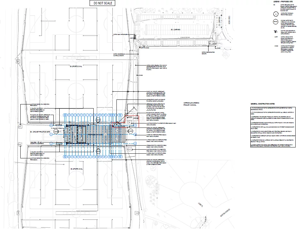
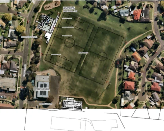
A site plan is a scaled drawing in a two-dimensional format which displays the layout of a built environment. It can be expressed through various mediums, ranging from a hand-sketched drawing to an Adobe Photoshop or AutoCAD illustration. They often represent a top-down perspective and frequently include buildings, roads, sidewalks, paths, drains, parking, and landscapes. They are generally designed by a design planner or design consultant who is a licensed engineer or land surveyor.
What does a site plan consist of?
- Property lines: Boundary lines between two or more properties.
- Surrounding streets: Provides a street view, portraying the roads, street signs and flow of traffic.
- Fire Hydrants: A connection point which firefighters use to connect the water tap.
- Driveways: Shows the exact dimensions of the driveway.
- Parking lots: Indicates the parking spaces, parking dimensions, area for turning and high traffic area.
- Setbacks: The space between the construction building and its property lines.
- Landscapes: Landscapes such as trees, arid land and water bodies are usually included.
- Easement: A part or feature of your property used by other individuals — for example, a pathway on your property leading into a park.
- Name and address of the building: Includes the name and address of the building in your locality.
- Location details: Details such as the longitude and latitude are provided.
- Scale diagram: All the charts in the sitemaps are scaled to a measurement.
- Legal description: Including details such as the person’s name & current address.
Why is a site plan essential?
Alongside a readable map of the working site (such as a building, parking lot or park), a site plan (or a plot plan) provides all the details of the oriented structure in an architectural document. Site plans also help the government with official recording by allotting them a building code. Additionally, site plans are designed with the consideration of pre-existing structures and allow space for the proposed construction of new buildings or structures. It is worth noting that the design for each building or structure can vary.
Site plans are generally scaled to some proportion, which allows us to continuously represent all the details in a smaller or practically calculated size. The typical scaling abides by construction industry standards. For example, a 1:10 scaling means that each 1 unit in the diagram is equal to 10 units in real life.